DynaCrop is being developed by the World from Space company based in Brno, Czech Republic. We are an experienced team of geospatial, IT, and environmental experts devoted to satellite data and agriculture. We are deeply passionate about merging tech with sustainability, and we firmly believe that satellite data can help get us there.
Our expertise
Crop growth stage prediction powered by AI
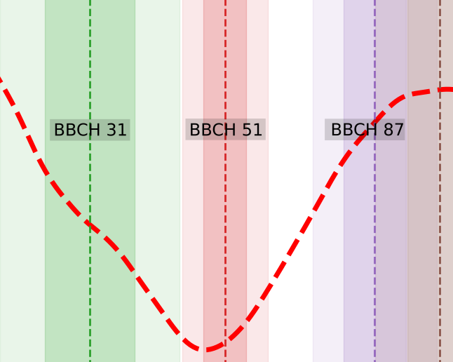
We use radar satellite imagery and weather data to predict crop growth stages with the help of artificial intelligence in our TAVAP solution.
As climate change alters crop development patterns, traditional crop calendars are becoming less reliable. TAVAP provides up-to-date information on crop phenology during the season, helping farmers plan time-sensitive operations such as spraying, fertilizing, and harvesting more effectively. Farmers can sort their fields by development stage and prioritise their actions.
TAVAP has been designed with the help of Mendel University, and it is being tested by farms and an agricultural holding (ADW), demonstrating its practical value and reliability in real farming conditions.
Soil moisture IoT integration with satellite imagery
We integrated data from IoT soil moisture sensors and local weather stations with satellite imagery to estimate soil moisture.
While IoT sensors provide valuable information for irrigation, their high cost and limited coverage often make it difficult to understand dynamic field-wide conditions. By combining these measurements with satellite data, our model delivers full spatial coverage, improving irrigation precision and helping farmers save water. The solution also helps with the placement of soil sensors to provide the most representative data.
The system has been tested in collaboration with Rostěnice, the largest farm in the Czech Republic, demonstrating its effectiveness and value in real farming conditions. We also cooperate with Bayer Mexico, which uses our data in their irrigation service.


Advanced mapping system for variable rate applications
Variable rate applications adjust fertiliser and seeding rates to each field zone’s needs, reducing costs and boosting yields. DynaCrop’s precision mapping system analyses soil fertility and crop potential to create detailed prescription maps tailored to individual fields.Each map is fully compatible with farming equipment, ensuring that variable rate applications are executed accurately and without technical errors.
The system has been continuously improved and optimised through field trials over three seasons in cooperation with farms and Mendel University. These trials focused on validating map accuracy and agronomic impact using yield data from fields.
Results confirm that farmers can reduce input use by up to 15% while achieving yield increases of 4–7%. The mapping system is now used by precision farming companies and integrated into farm management platforms to support data-driven, efficient crop production.
Field trials with farms
Testing, optimizing, and adopting new farming approaches requires hands-on field trials, where farmers can gain experience with new technology and assess its impact on their own operations. DynaCrop provides field trial design and evaluation as a service and currently conducts trials with more than 10 partner farms and precision farming collaborators.
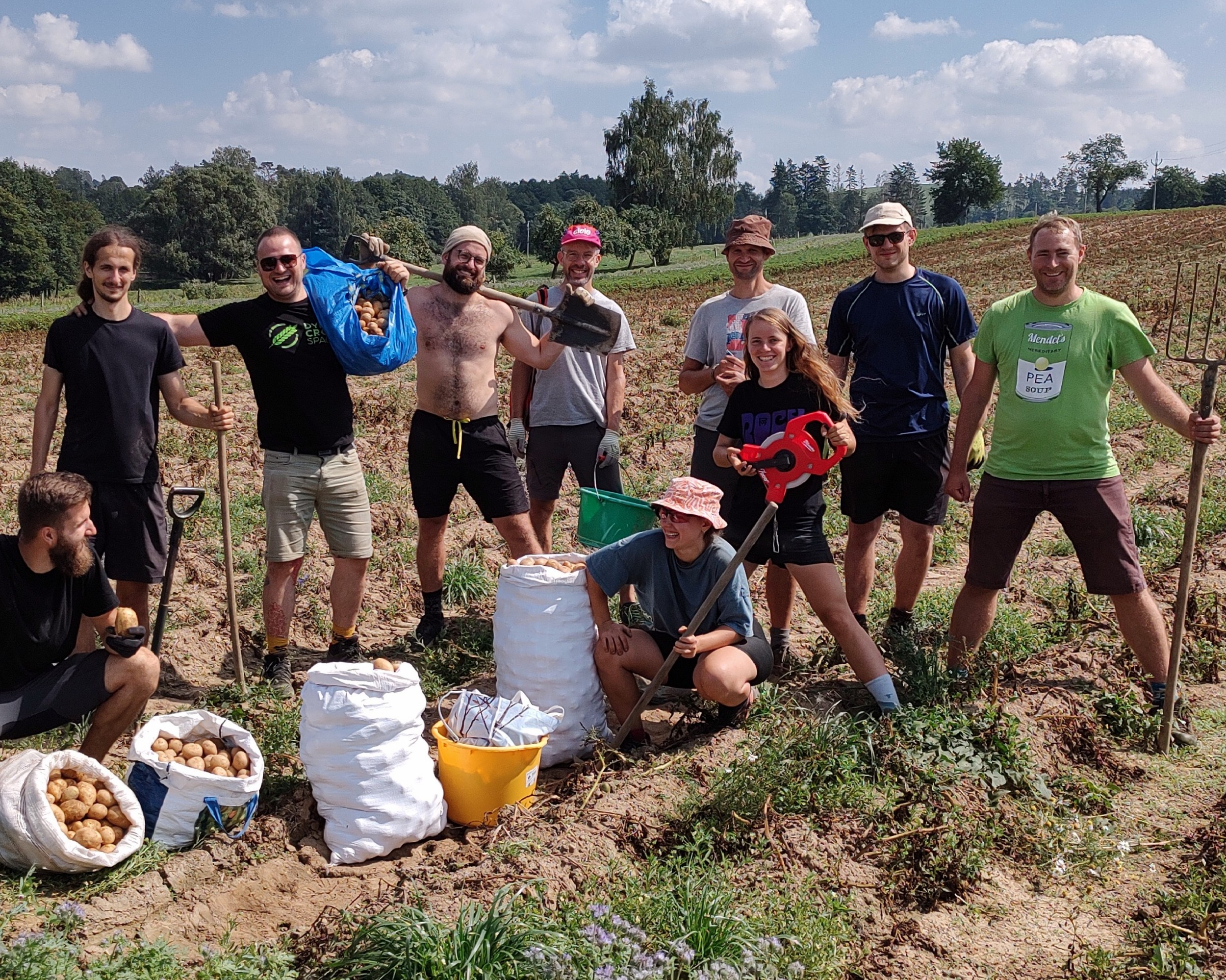
Past trials have included variable rate seeding of winter wheat, variable rate planting of potatoes, variable rate nitrogen application in cereals and rapeseed, and variable rate plant growth regulation.
For each trial, our team designs the experiment, collects and evaluates data, and discusses the results with all stakeholders. We identify suitable treatments and strategies, assess their financial impact, and recommend adjustments to improve efficiency and maximize the benefits of precision farming innovations.
Our Customers
ADW Agro – Farm Effect (Czechia)
ADW Agro has integrated crop monitoring and precision farming maps directly into its Farm Effect management platform using our DynaCrop API. This allows farmers to access variable rate application maps seamlessly within their existing farm management system.
DynaCrop, Mendel University and ADW also validate the integrated technology through field trials. Plant, soil, and yield data collected from farms is used to validate the system.
Benefits for ADW:
- Expansion service portfolio beyond their soil sampling business
- Seamless integration into their farm management system
- Crop monitoring and Variable rate maps
Impact on Farmers:
- Improved nitrogen and seed use efficiency
- Increased crop yields through precise management
Paul-Tech (Estonia, UK)
Paul-Tech integrates our crop monitoring system with its IoT soil and weather stations to support smarter nitrogen fertiliser management. By combining in-field sensor data with satellite-based crop monitoring, farmers gain a complete view of crop condition and nutrient dynamics throughout the season.
The system uses satellite observations to estimate nitrogen uptake and adjust fertiliser rates according to plant needs, helping optimise timing and rates.
Benefits for Paul-Tech:
- Enhanced value of their IoT soil and weather data through satellite integration
- A more comprehensive digital agronomy service for customers in their app
- Full spatial coverage with maps showing growth variability across the field
Impact on Farmers:
- Improved fertiliser use efficiency and crop performance
Bayer (Mexico)
Bayer Mexico uses DynaCrop’s plant and soil moisture analytics to support the installation and management of modern irrigation systems. Data from satellite monitoring and field measurements are compiled into clear, easy-to-read reports and dashboards that help optimise irrigation planning and efficiency.
The system provides continuous insights into crop water status, helping identify when and where irrigation is needed most. This approach supports water conservation while maintaining healthy crop growth and yield potential.
Benefits for Bayer:
- Reliable data source for irrigation system management
- Improved service quality through transparent digital reporting
Impact on Farmers:
- Optimised irrigation scheduling
- Increased water use efficiency and crop performance
Livona (Serbia)
Livona uses DynaCrop soil sampling maps to assess soil variability and plan representative sampling across their fields. By mapping soil properties in greater detail, the company gains a clearer understanding of nutrient distribution and field potential.
This information supports precise nutrient management, allowing fertiliser applications to be adjusted according to actual soil nutrient content and crop requirements in high detail.
Benefits for Livona:
- Improved accuracy of soil sampling analysis
- Enhanced service quality
- Faster sampling and delivery
Impact on Farmers:
- More precise fertiliser applications
- Better nutrient use efficiency and balanced soil fertility
Meet DynaCrop team


About company
World from Space
World from Space is a geospatial SME company based in Brno, Czech Republic, focusing on satellite data analytics. The key expertise lies in cloud data processing (multispectral, SAR), spatial and temporal data analysis, visualizations, machine learning, and integrations into software platforms or GIS. We are passionate about merging deeptech with Earth sciences for regeneration of environmental, economic and social systems.