Use Cases
-
Crop Monitoring
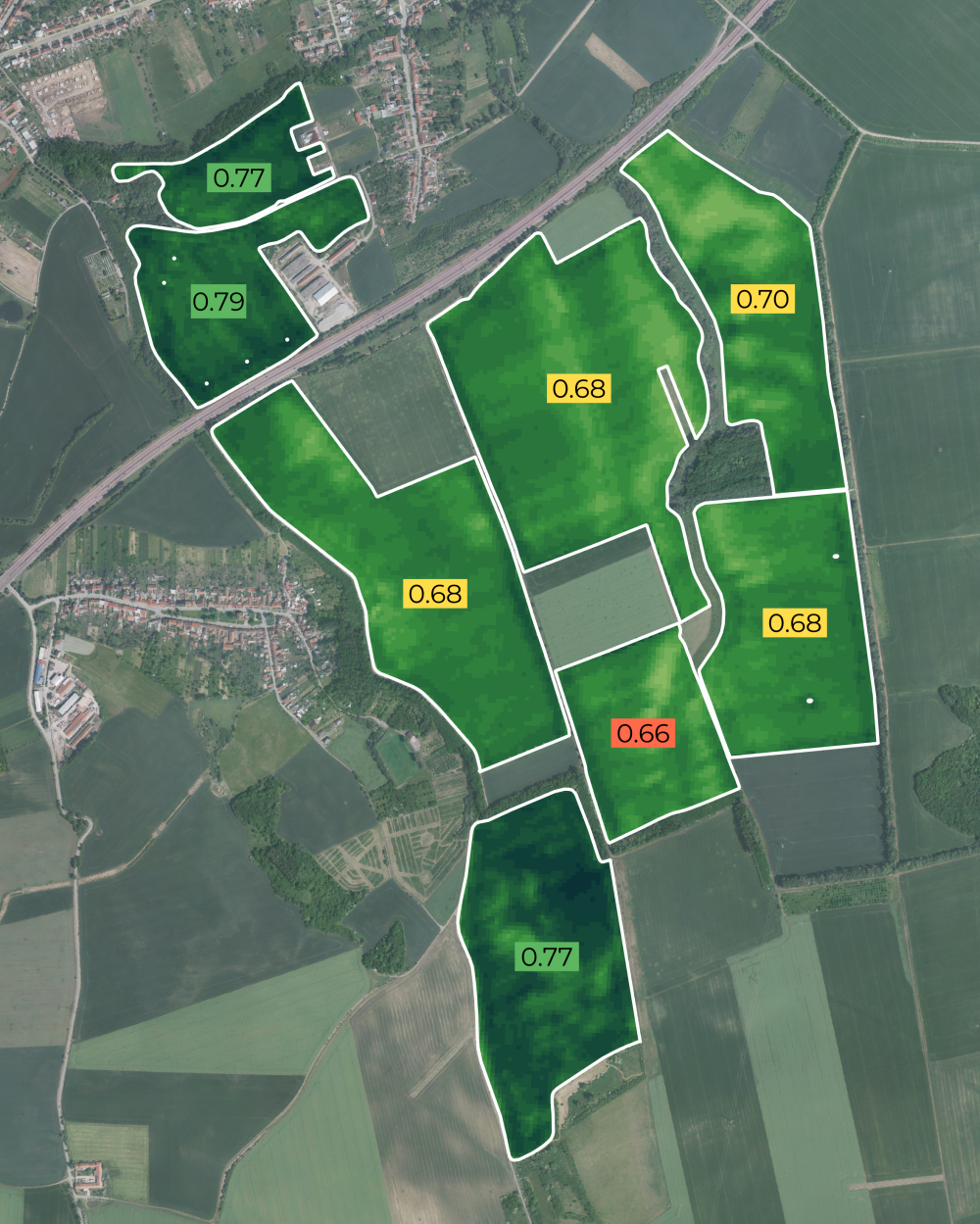
Use satellite imagery to observe and analyse crop conditions, growth stages, and productivity over time, providing large-scale, timely insights into agricultural performance. Detect stress, estimate yield, and support smart farming decisions.
- green biomass
- leaf area
- chlorophyll content
- canopy water content
- soil moisture
- blooming intensity
- crop growth stages
- high resolution imagery (3-10 meters)
- daily or weekly revisit
- 22+ indices
- reports
- anomaly detection
- plot benchmarking
Success Story

-
Variable Rate Applications
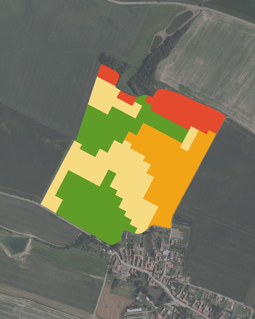
Create Variable Rate Application (VRA) prescription maps to apply inputs such as seed, fertiliser, or pesticides at rates tailored to the specific needs of different areas within a field. Management zones based on soil fertility and crop characteristics improve input use efficiency and increase yields.
- management zones
- nitrogen fertilising
- seeding
- irrigation
- productivity (fertility) maps
- adjusted for specific farming equipment (swath width, level of detail)
- tested in field trials
- increase yield
- increase input use efficiency
Success Story
-
Soil sampling

Use satellite imagery to guide zone-based soil sampling by identifying areas within a field that differ in soil reflectance, yield or soil moisture. Sampling based on remote sensing insights ensures that soil tests capture real variability in field conditions, leading to more precise nutrient management and more cost-efficient soil analysis using less samples.
- soil variability mapping
- zones with different crop traits
- representative zones for sampling
- custom zone parameters (size, complexity)
- zone shapes and point coordinates
- optimised sampling locations for accurate soil nutrient management
Success Story
-
Irrigation
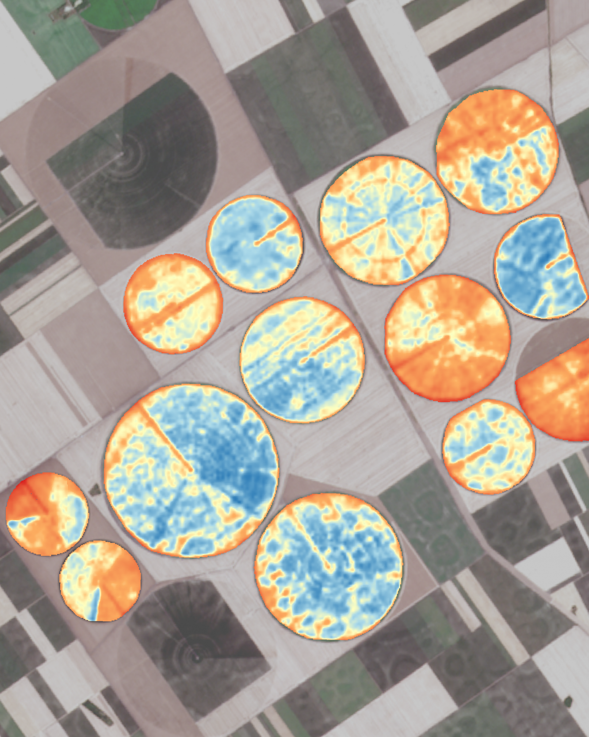
Use satellite imagery to monitor crop water status and identify areas experiencing moisture stress. These insights help farmers schedule and adjust irrigation more precisely, ensuring optimal water use and maintaining consistent crop growth across the field.
- plant and soil moisture monitoring
- water use efficiency
- optimised scheduling
- rate management
- drought analysis
- suitable positions for IoT sensors
Success Story
