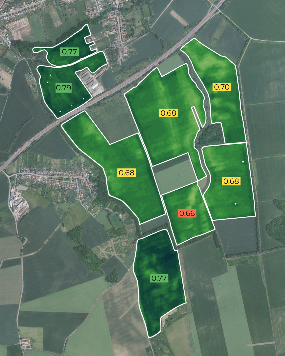
Use satellite imagery to observe and analyse crop conditions, growth stages, and productivity over time, providing large-scale, timely insights into agricultural performance. Detect stress, estimate yield, and support smart farming decisions.
- green biomass
- leaf area
- chlorophyll content
- canopy water content
- soil moisture
- blooming intensity
- crop growth stages
- high resolution imagery (3-10 meters)
- daily or weekly revisit
- 22+ indices
- reports
- anomaly detection
- plot benchmarking