Dynacrop’s eyes in space – satellites we use for field monitoring
DynaCrop is bringing information from space to its clients all around the world. But where does this information come from and which satellites are we using?

The main information in DynaCrop originates from the European Sentinel satellites of the Copernicus Programme. This data is provided free for public and commercial use by the European Commission, who manages the programme in partnership with the European Space Agency (ESA). Copernicus is nicknamed “Europe’s Eyes on Earth”, which perfectly sums up the most important feature of the programme – its global coverage. Our DynaCrop is proud to be one of the applications using it.
But what are we really talking about when we use terms such as “Copernicus”, “Sentinels”, or “space data”? Let’s go step by step and explore the fascinating world of satellites, Earth Observation, and space technologies.
The story of Europe’s very own satellite programme started more than 20 years ago and now there are seven satellite missions in orbit, sending all kinds of information back to Earth. Every Sentinel is a little different and the data can be used for different purposes – some watch the growth of cities, others observe the rise of sea levels, air pollution or temperature of the Earth’s surface. For DynaCrop, there are two important Sentinel missions – Sentinel-1 and Sentinel-2.
Those two deliver the data processed by DynaCrop and are used for the creation of our products.
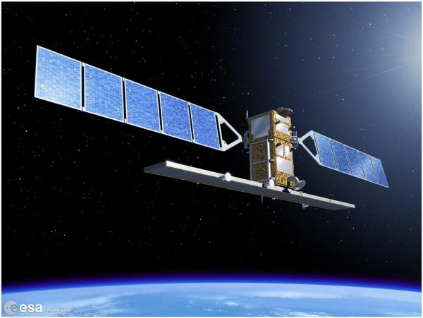
The Sentinels carry measuring equipment which allows them not only to high-resolution pictures of Earth, but also to sense different parameters of the Earth’s surface. For example, Sentinel-2 is able to see Earth on 13 spectral bands, most of which are outside of the visible light spectre. Sentinel 1 is a radar satellite, so it provides a completely different sort of information. This means that the satellite can see way more than we see with our eyes and broadens the amount of information we can get about the vegetation.
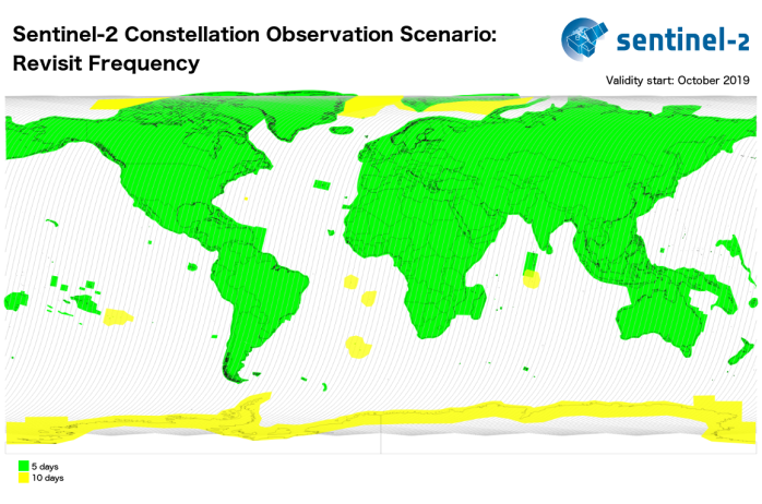
Thanks to the fast revisit time and global coverage of the Sentinel satellites, DynaCrop can watch and assess every field across the whole world. Whether you are a farmer in Canada or Nigeria, you can always rely on DynaCrop and its data sources. The satellites will always keep watch over your fields and crops from orbit.