Introducing LAICA: Weather-independent satellite crop monitoring
Cloudy weather cannot stop us from giving you data. A new feature of DynaCrop is delivering fresh data every second day regardless of clouds, mist, dust and rain.
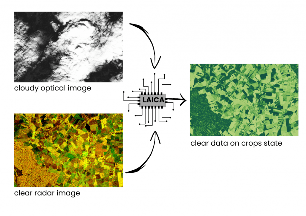
Farmers need data about their fields when it is necessary, not when the data is available. The weather has always been the biggest problem for satellite crop monitoring. It is easy to process images captured during nice weather. However, when the clouds appear, it is not possible to get information about the fields with traditional satellite monitoring methods. That is when the fusion with radar data comes in. The radar is able to pierce through thick clouds and mine the data anyway. With LAICA, you will never experience data gaps anymore.
Continuous monitoring for precise timing
The precise timing of field interventions such as fertilizing, irrigation and harvest is a key element of successful agriculture management. Yet with no data on crop state and development, there is nothing much to lean on. It is quite annoying when an agronomist wants to take a look at the fields, but cannot see anything due to cloudy weather. Such conditions might take weeks or even months before getting a clear satellite image, but usually, there is no time to wait.
That’s why we came up with the solution to pierce through the clouds to get the information whenever it is needed. With LAICA‘s weather-independent satellite crop monitoring, the DynaCrop system becomes even more reliable. Thanks to our fusion of multiple Sentinel satellite systems we can guarantee new clear data for whatever field around Europe every second day.
How is it possible to see through the clouds
The problem of conventional satellite monitoring for farming was that it was dependent purely on optical data. Unfortunately, the optical satellite view is also naturally blocked by clouds. This can be solved by radar satellites that we already use for soil moisture monitoring. Radars actively send microwave signals to the Earth’s surface and record what comes back. Thanks to the different wavelengths used there is no influence of clouds whatsoever (unless you are in the middle of a hurricane). It is not limited to daylight, so this principle works with the same quality even during the night.
Sentinel-1 radar satellite: Seeing through clouds (Credit: ESA/ATG medialab)
Don’t worry, it is not RVA
But simple solutions usually don’t work. You might come across the opinion that traditional methods based on radar vegetation monitoring are simply useless. And it is true. The radar vegetation index (RVA) that some companies present as a solution simply does not provide comparable information about crops’ vitality and density that farmers can understand. It might be useful for some specific use cases, but generally not.
Optical and radar fusion
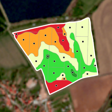
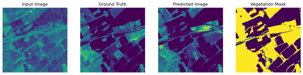
We designed LAICA in a much different way. It provides information on the synthetic optical Leaf Area Index (LAI) which is the second most used vegetation index after NDVI. LAI is ideal for monitoring plant growth and it is an important parameter when considering irrigation, fertilization and the use of foliar sprays, such as fungicides and pesticides. It also tells us about biomass accumulation which is closely related to yield.
Our advanced AI deep learning methods combine optical and radar satellite data to create fusion-LAI based on millions of data examples from the past. Not only that resolves the problem of data gaps during cloudy weather but it also dramatically increases the frequency of newly available data. Fresh field information once every two days is quite a huge step forward. Usually, optical Sentinel-2 can provide around 45 clear data images per year, but with LAICA we can raise the yearly frequency to 182!
.
Join our free testing
Are you ready to test LAICA in your fields or in your software platform?
Let us know and learn more about the free testing possibilities.
| Независимый от погоды спутниковый мониторинг посевов | Nezavisimyy ot pogody sputnikovyy monitoring posevov | radar data | deep learning | machine learning | artificial intelligence | through clouds | field monitoring | cloudless monitoring | daily monitoring | vegetation prediction | crops state | crops dynamics | cloudfree | precision agriculture | AI | irrigation timing | harvest timing | fertilizing timing | crop monitoring | crop health | cloudless farming | cloud-free data | LAI | crops prediction | satellite fusion | Leaf Area Index | cloudless satellite crop monitoring | yield prediction | biomass density | weather-independent satellite monitoring